Essential Information
| Location |
Royal Observatory
|
|---|---|
27 Mar 2015
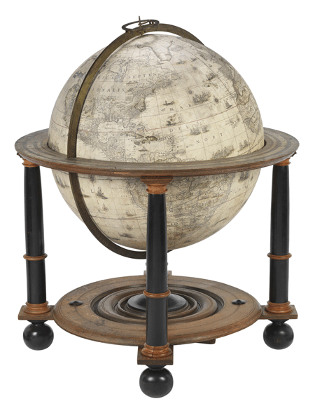
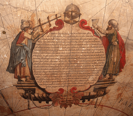
Although the beginning of longitude is arbitrarily selected nevertheless it pleased the ancients to begin the counting of it from the west, because there was the limit of the earth, as some thought, while no expedition to the east was able to determine this. Therefore Ptolemy, to whose application and industry all men, even though unwilling to admit it, owe the preservation of geography (geographical science), made the location (of the beginning of longitude) in the farthest known limit of the west, which is called the Fortunate Islands, in the Atlantic Ocean, and in them he fixed the first meridian. This hypothetical beginning, almost all who came after him retained because of his influence. But in our century there are some who have said that this beginning should be taken from nature herself, and in this matter they have taken the indication of the magnetic needle as their guide, and fix the first meridian in that place in which the needle points to the true north: That this is clearly an error is proved by this additional (and peculiar) property of the magnetic needle, that on the same meridian it has a variation according as it is near to this or that continent. But the very men who think this, on account of the uncertainty of the variation, disagree much among themselves as to where the first meridian is to be located, and so for the highest good of geography, that this same fixed meridian as a first beginning may be marked and be retained, we ourselves, following in the steps of Ptolemy, have chosen the same islands as he, and from their number that one which is called Juno, or commonly Tenerif ; of these (islands) that high and steep rock beset by perpetual clouds and called by the natives El Pico, shall for us be the location of the first meridian. In this matter, from the longitude of the Arabs, who selected the shore of Africa farthest toward the west, we vary scarcely the fourth part of a degree, and this I thought worthy to be noted.I think this wonderfully expresses the arbitrary nature of any meridian, including what is now the Prime Meridian through Greenwich. For the globe, incidentally, Blaeu used Tenerife as his prime meridian, as many others did at this time. But charts might choose one of a number of meridians from which to measure longitude well into the eighteenth century and beyond. Some even hedged their bets and included several meridians: this chart of 1753 by Jacques Nicolas Bellin identifies the meridians of Paris, London, the Lizard, Tenerife and Ferro (El Hierro):
