17 Oct 2022
This month we look at The Theatre of the Empire of Great Britaine, the first English attempt at a comprehensive survey of these islands, created by John Speed for James VI & I in 1611
by Shane McMurray, Library Assistant
From tailor to scholar
The Theatre of the Empire of Great Britaine was the work of historian and cartographer John Speed (1551/2-1629). A tailor by trade, Speed developed interests in genealogy and cartography later in life. Eventually, through the patronage of poet and parliamentarian Sir Fulke Greville, he was able to pursue his scholarly interests full-time.
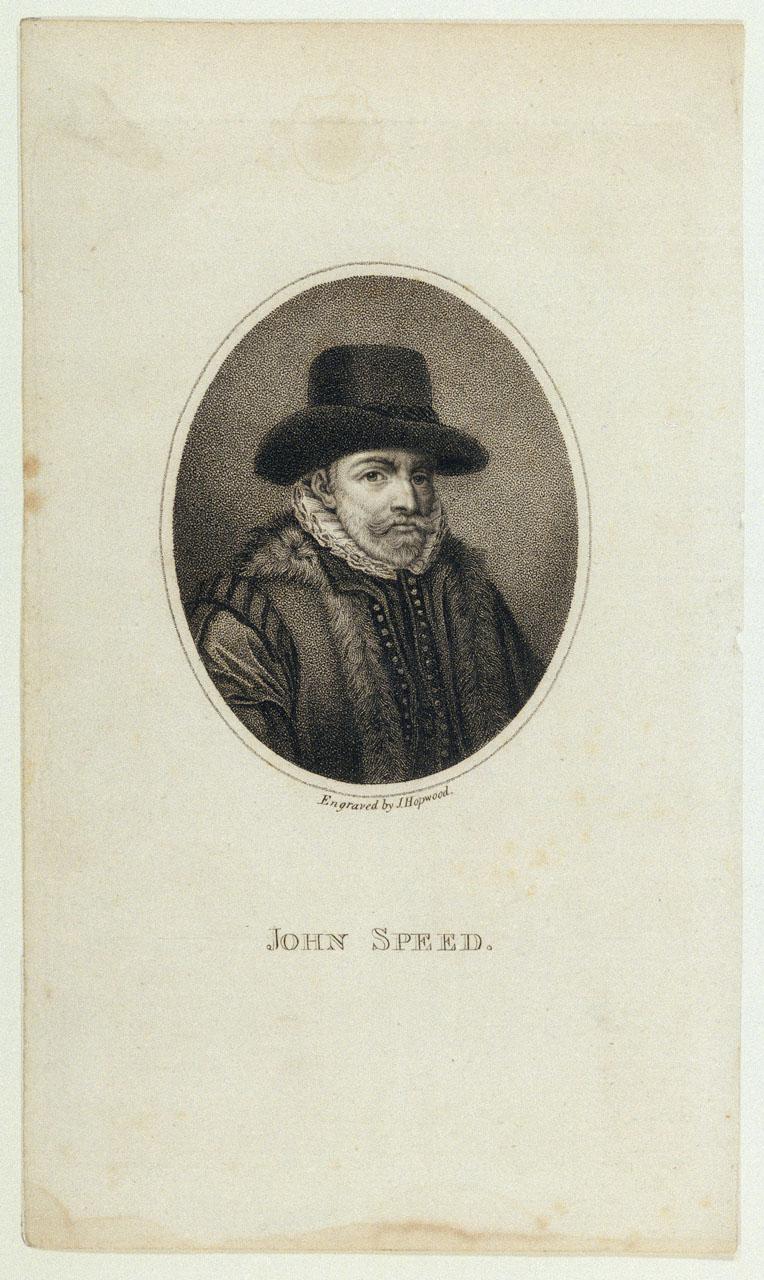
Greville introduced him to the Society of Antiquaries, where he met, among others, the English antiquarian William Camden. Speed presented maps to Queen Elizabeth I and contributed material on the coinage to Camden’s Britannia (1600, Caird Library ID: PBB3998), the first chorographical survey of Britain and Ireland. It was during this time that he embarked on The Theatre and his accompanying lesser-known The Historie of Great Britaine.
Speed was fortunate to be able to draw on contemporary topographers Christopher Saxton and John Norden; antiquarian Sir Henry Spelman; and bibliophile Sir Robert Cotton, whose collection later formed the basis of what became the British Library, for assistance. Their collections and works were instrumental in his research.
Theatre and Historie: the chorographical and historical parts
The Theatre is the first - or chorographical - part of a two-volume magnum opus. The second volume comprises Speed’s Historie of Great Britaine, referred to as the historical part. It chronicles the ancient Britons and the reigns of Roman emperors, Saxon, and English monarchs up to James VI & I. London publisher George Humble was granted the privilege to print both works in 1611-12. For The Theatre, plates were engraved by Amsterdam-based Jodocus Hondius.
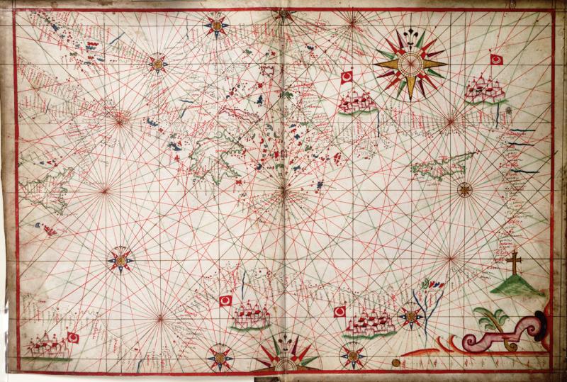
The Theatre was modelled on Abraham Ortelius’s 1570 atlas Theatrum orbis terrarum (Theatre of the Orb of the World, PBD7645) in format and title, displaying a combination of geographical and historical information. While it is principally comprised of English and Welsh county maps, other realms are not neglected.
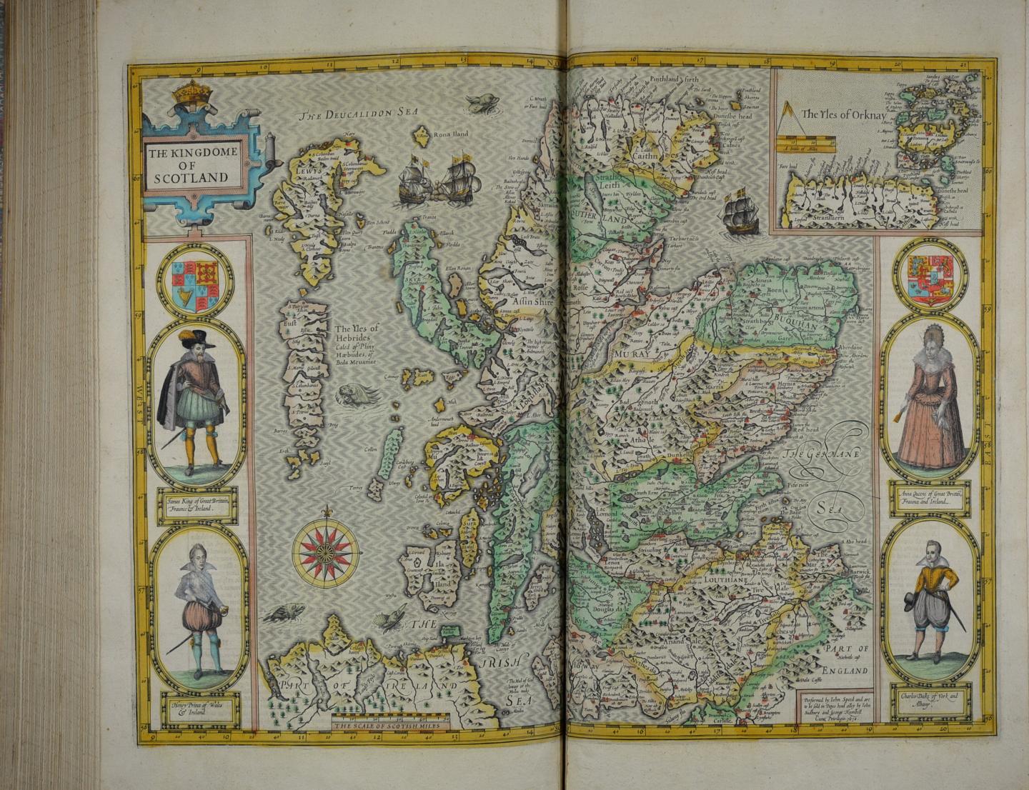
Notably, the first detailed maps of the Irish provinces of Munster, Connacht, Ulster, and Leinster make an appearance. Only a general map of Scotland is provided as the Scottish minister and cartographer Timothy Pont was busy surveying there at the time. Maps of the Isle of Man, Jersey, and Guernsey also feature.
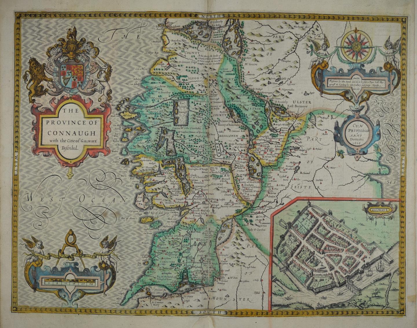
Maps are accompanied by information on topics such as antiquarian remains and famous battles. Each map is illustrated with the armorials of princes and nobles and plans of major population centres.
From kingdom to county, city to village, no detail was overlooked. This was an atlas on a grand scale. Such was its success that it became the basis for subsequent folio atlases for the next 150 years.
The Museum is fortunate to have three copies:
- PBE6831 (1611), colour. Carries the signature of Wijbrandt on the title page, and the ex libris of James Hatton and Victorian antiquary Richard Henry Wood on the bookplates. It was later acquired by our founding benefactor Sir James Caird, who presented it to the Museum in 1941.
- PBE6834 (1611), first edition. From the Macpherson Collection, a founding collection of the National Maritime Museum.
- PBE6833 (1676), colour. Macpherson Collection. Includes Speed’s A Prospect of the Most Famous Parts of the World, first published in 1627.
A Stuart Theatre
A nod to the Scottish origins of the new British Royal Family is included in The Theatre. Small full-length portraits of the King and Queen, with their sons Henry and Charles, decorate the map of Scotland.
Speed began work on The Theatre and Historie in the last years of the reign of Elizabeth I. When King James VI of Scotland succeeded to the English and Irish thrones in 1603, the project took on an added significance.
For the first time Scotland, England, and Ireland found themselves united under a single monarch. Each kingdom was nominally independent, yet control was exercised centrally from London, where the new Stuart King had relocated his court from Edinburgh.
Consequently, The Theatre took on a distinctly British flavour. The new Royal coat of arms, reflecting James’s new triple crown status, frequently appears. There is also high praise for the King in Speed’s dedication to James, who is referred to as an ‘uniter’ and ‘restorer’:
"To The Most High and Most Potent Monarch, James, of Great Britaine, France, and Ireland King; The Most Constant and Most Learned Defender of the Faith; Inlarger and Uniter of the British Empire; Restorer of the British Name; Establisher of Perpetuall Peace, in Church, and Commonwealth; President of al Princely Vertues and Noble Arts."
Speed was known to have produced maps for James, and this may have been a way to express his gratitude for the King’s patronage. The Theatre would continue to be published beyond Speed’s lifetime and well into the reign of James’s grandson, Charles II.
To view these items in the Reading Room of the Caird Library and Archive, please register with our online ordering system, Aeon. You can then request items via the Library catalogue on Collections Online.
Further Reading
Bendall, Sarah. Speed, John. Oxford Dictionary of National Biography. Online. 2008.
Hind, Arthur. Engraving in England in the Sixteenth & Seventeenth Centuries by Cambridge: Cambridge University Press, 1952-55. PBD2195/1-2.
Skelton, R.A. County atlases of the British Isles, 1579-1850. London: Carta, 1970. PBE8846.
John Speed: Biography. MapForum Magazine. Issue 2, January 2022. Online at: https://mapforum.com/2022/01/14/biography-john-speed/
More blogs from the Caird Library