Discover the story behind one of the most detailed maps of the Moon ever created.
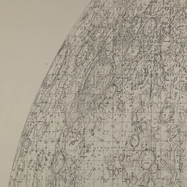
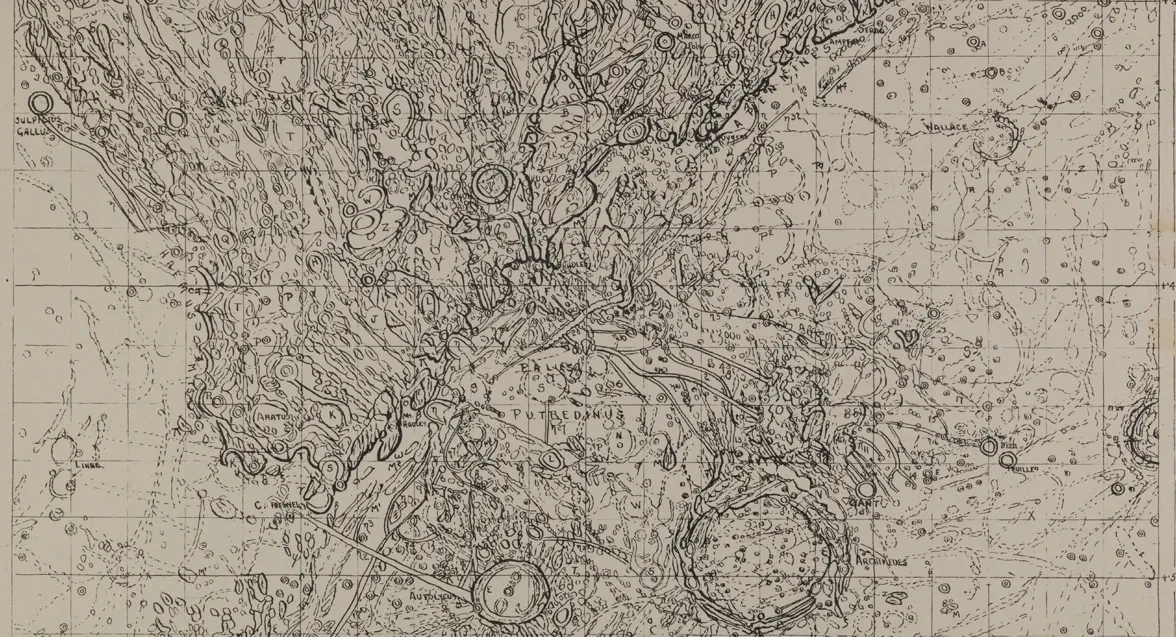
The first thing that strikes you about Hugh Percy Wilkins' Map of the Moon is the detail.
Countless lines squirm and squiggle across the page. Thick black circles mark the rims of craters. Neat, handwritten labels identify the names and locations of lunar features. Ridges, pits and boulder fields are all meticulously documented.
The second thing that strikes you is the scale. The work is made up of 25 individual sheets, which together create a map over two and a half metres across.
“The Wilkins Moon map is a 100-inch diameter map of the Moon, published in the 1950s,” Dr Megan Barford, Curator of Cartography at Royal Museums Greenwich explains. “When it was published, it was the most detailed map of the Moon that had ever been made.”
“It is breathtaking to look at something that required so much work,” Dr Barford says.
“Think about the number of times that each feature would have been observed, the number of people who were making those observations and the work required to compile them. Think about all the work that goes into telescope construction. Then think about Wilkins’s family, and the fact that he was an amateur doing this in his home.”
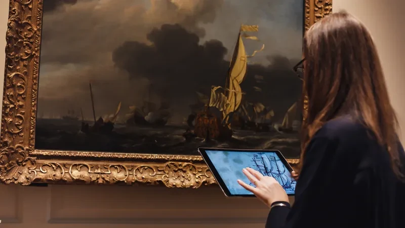
In an era when anyone can turn on their computer and spin around the Moon via Google Maps, the hand-drawn dedication of the Wilkins Moon map feels almost otherworldly. Find out more about the story of its creation with Dr Barford below.
Who was Hugh Percy Wilkins?
Hugh Percy Wilkins (1896-1960) was a Welsh amateur astronomer who observed the Moon principally from his garden in Bexleyheath – just down the road from Royal Museums Greenwich. He also made visits to major observatories around the world, including in France, North America and here in Greenwich.
For his day job, Wilkins was a civil servant, so all of the Moon work he did was outside of his regular employment. That said, ‘amateur’ during this period does not imply a lack of seriousness. Amateur astronomers in the mid-20th century were extremely serious about what they did, and their work often had a strong research element.
How was the Moon map made?
One of the fascinating things about observing the Moon is that what it looks like changes hugely as different areas are illuminated. From looking at the Moon just on one occasion, you can’t necessarily tell the shape of a particular feature. You can only work that out over time, as the shadows on its surface change.
By bringing together a series of observations of the same feature, Wilkins was able to document the changing shadows. From there he was able to work out what the shape of the feature actually was: it's the outlines of those shapes which we see on the map.
What did Wilkins use to draw the Moon map?
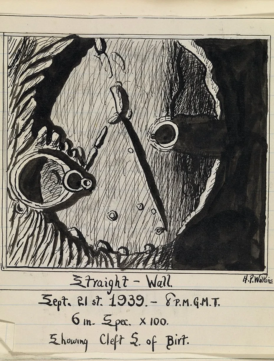
Wilkins used pencil and ink to produce both his drawings of lunar features and his map. In drawing lunar features, he used thick black ink on white paper to show the stark contrast between light and dark on the Moon, which many observers commented on. In his map, he used a combination of symbols to show dark streaks, ridges, clefts, pits and larger craters on the Moon’s surface. The map is actually a reduction of the manuscript version, which had a 300-inch diameter, and the way it was produced retains the style of the manuscript.
Did he do all the work alone?
Astronomical work is never done alone. Wilkins was director of the Lunar Section of the British Astronomical Association, so he was in correspondence with many other people who were observing the Moon. They would discuss what they had seen, how they built their telescopes, how they drew.
When Wilkins was making his map, he was drawing on observations made by a range of people. He used photographs, existing maps and observations by other people that he would then check with his own telescope in his garden. It is a work of compilation as well as observation.
How long did it take to map the Moon?
It was a lifetime’s work. His first, much smaller Moon map was published in 1924. The first edition of this map was made 1946, but later editions were added with detail from further observation. The one we have on display is the third edition, published in 1951. Wilkins was still observing up to his death - plans for further maps of the Moon were never realised.
How was the Moon map used?
The map was a tool for use at the telescope. Observers would use the sheet showing the area they wanted to focus on, and use the map as a reference guide. The amateur astronomical journal The Strolling Astronomer insisted that “all students of the Moon should have it”.
We also know that NASA bought a copy during the Apollo Program, although we don’t know how they used it.
How did people respond to the map when it was published?
The map was criticised when it was published for being too detailed and overcrowded. Wilkins was working in a tradition which prized greater and greater detail from telescopic observation; in some ways his map marks the end of that tradition.
It so happened that the space programs of the 1950s, 60s and 70s radically changed the sorts of data available as well as the understanding of what was useful in a lunar map. Wilkins’ map, with its meticulous, hand-drawn style, is often described as the last of its kind.
Is the map science… or art?
Cartography is a graphic art. It is also a science!
It is always important to remember the centrality of artistic technique to a lot of what we think of as ‘science’. A highly developed relationship between eye and hand was often really important. And this 'looking and drawing' was not incidental to, but at the heart of, a lot of the interpretive work of astronomy.