
Thanks to the work of librarians and curators at the Osher Map Library in Maine, USA, we now know a lot more about the range of women’s involvement in the map trade. Their work highlights the variety of roles women occupied, working as surveyors, compilers, engravers, publishers, and sellers.
Looking at the chart trade in earlier nineteenth-century London similarly reveals women were involved in a number of ways, all integral to the provision of navigational information to seagoing vessels.
Our Curator of Cartography, Megan Barford, reveals the vital role women played in aiding navigation at sea.
Penelope Steel
For example, there was Penelope Steel, who was born in Jamaica in 1768. She took over a chart and nautical book publishing business on Union Row, Little Tower Hill, on the death of her husband, David Steel, in 1803.
Image
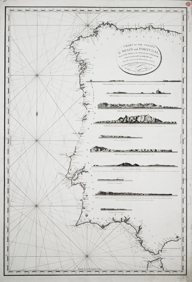
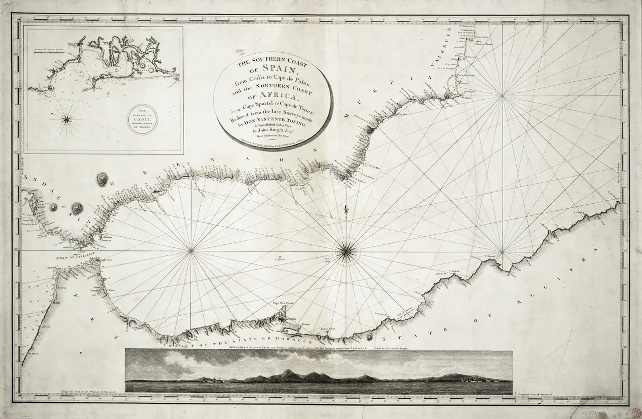
There are several examples of the charts and books published by her in the collections of the National Maritime Museum. Two of these are a ‘Chart of the coasts of Spain and Portugal, from Cape Pinas to the Strait of Gibraltar…’ (1804) [G225:1/1] and ‘The southern coast of Spain, from Cadiz to Cape de Palos, and the northern coast of Africa, from Cape Spartel to Cape de Tenez…’ (1804) [G231:1/7].
They are fairly typical of commercially published charts from this period. They show a range of coastal profiles, ‘rhumb’ lines indicating the compass bearings by which many mariners sailed, and are backed onto blue paper for reinforcement that was so common it earned commercially produced sea charts the name of ‘bluebacks.’
Mary Roberts
Elsewhere, there was Mary Roberts who for a short period in the 1830s managed the copperplate printing to produce charts for the Hydrographic Office of the Admiralty (founded in 1795), which made charts both for the Royal Navy and for sale to a buying public. Similarly to Steel, she took over this work on the death of her husband.
Though forced out of working for the Admiralty when they changed the terms on which they employed a printer, she continued to run a printing establishment at Villiers Street, The Strand. Indeed, when later in the 1830s she heard of problems with the Admiralty copperplate press, Roberts wrote to the Hydrographic Office offering the use of her own press on Villiers Street.
Janet Taylor
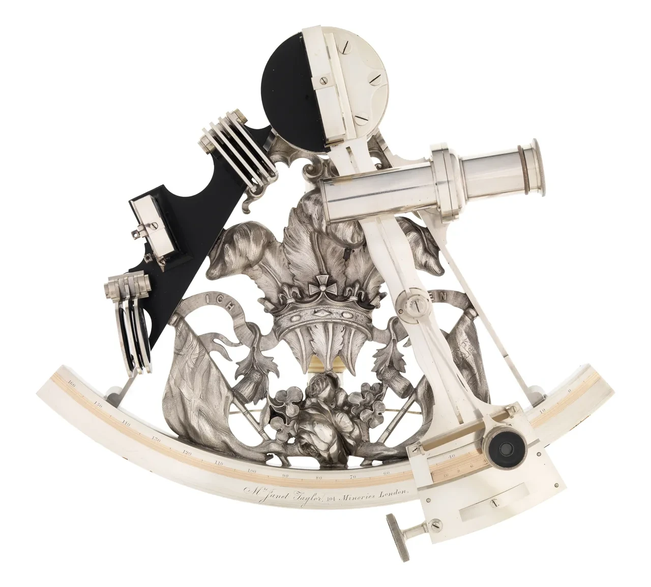
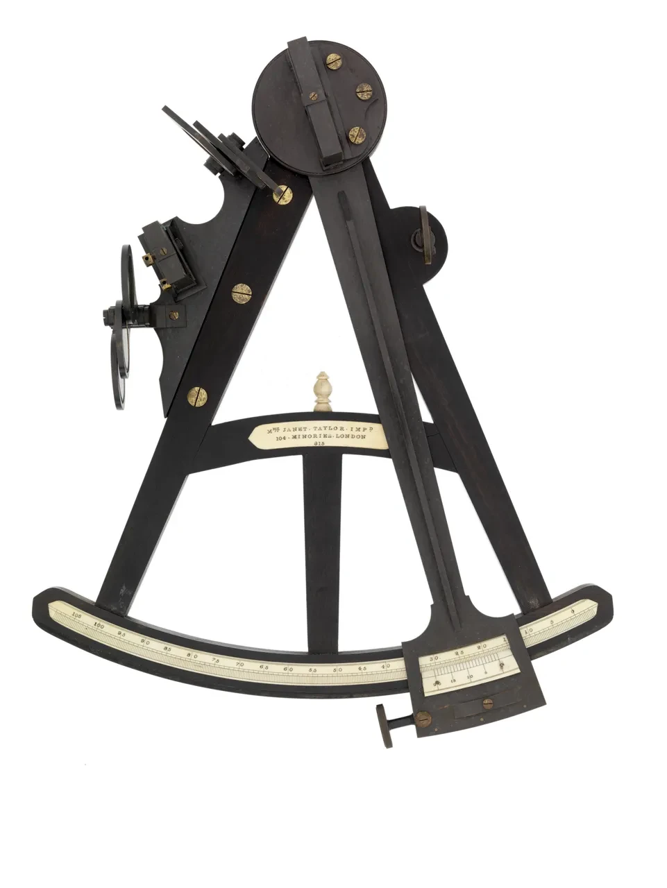
One of the women most prominently involved in the chart trade in London in this period was Janet Taylor, who was a sub-agent for Admiralty Charts, selling them from her business premises on Minories in the City of London.
Taylor was also an instrument maker, writer and navigational instructor. The National Maritime Museum has a number of instruments and navigation books which bear her name, including this highly decorative quintant [NAV1135], and this more practical ebony-framed octant [NAV1293].
Charting new directions
In Steel, Roberts, and Taylor, we see three women playing a very active role in the chart trade. Here publishing, printing, selling, and, in the case of Taylor, also teaching, take us beyond the names which tend to be written largest on charts from this period, those of the hydrographic surveyors who managed the measurement of angles and the production of surveys which were eventually turned into charts.
Acknowledging this work helps to show the range of tasks – in this period all essential – involved in providing navigational information to mariners. This in turn allows for a richer understanding of charts not just as delineations of commercially, imperially or strategically important coastlines (and they were certainly this), but also as objects, made and sold, which relied on the work of a host of people all too often unknown.

Stories
From deep space to ocean depths, discover the stories of our world with Royal Museums Greenwich. Browse online articles, hear from museum curators, astronomers and special guests, and take a deep dive into our collections and archives