
Explore this stunning 16th century table globe - in 3D
Take a virtual spin and explore one of the National Maritime Museum's most important globes.
Explore the globe from home
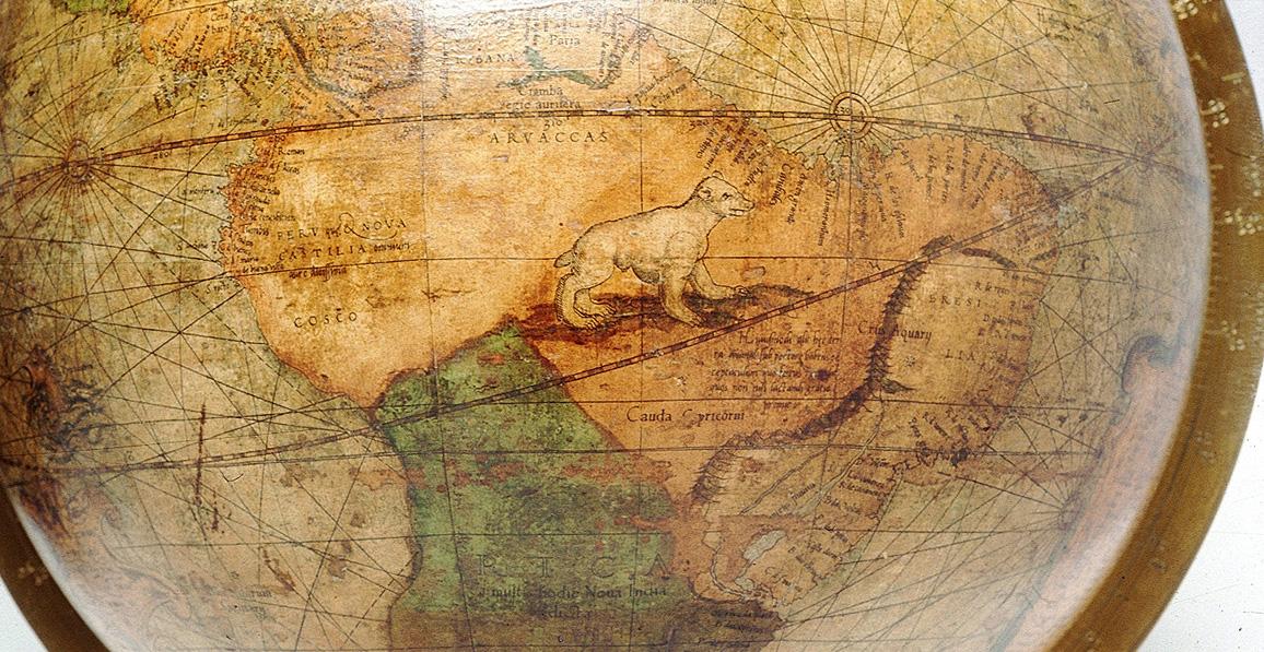
This table globe, created in 1541 by cartographer Gerard Mercator, is one of the treasures of the Royal Museums Greenwich collection.
Normally you can see it in the National Maritime Museum - but as we're closed, we wanted to make it available to you to explore right here online.
Discover more stories and collections
Click the link below to launch the virtual viewer. Then it's up to you where to choose to travel.
Spin the globe and search for your favourite country, or zoom in to take a closer look at the incredible detail and the strange creatures that pepper its surface.
See what the world looked like through sixteenth century eyes.
About the Mercator terrestrial and celestial globes
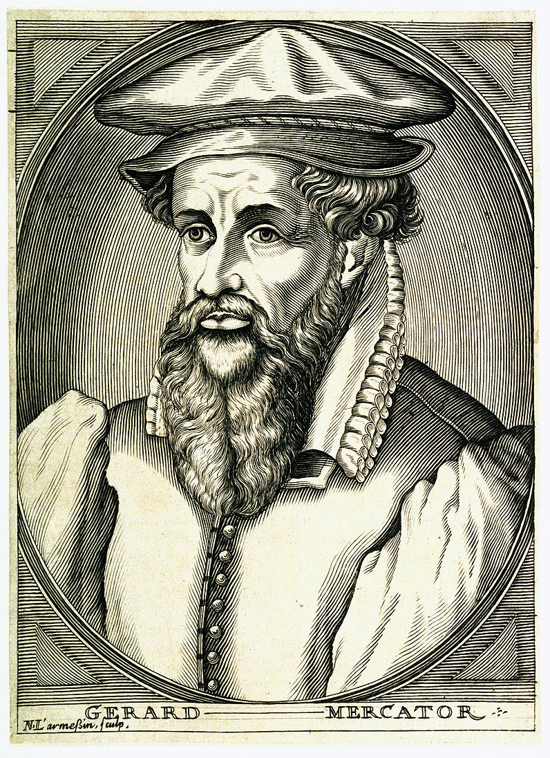
When Gerard Mercator (1512-94), the most famous cartographer of the sixteenth century, made this terrestrial globe and its companion celestial globe, they were the largest printed examples ever made.
Completed in 1541 and 1551 respectively, he made them against a backdrop of increasing cartographic sophistication and mathematical learning, as well as deep religious strife.
In the years before 1541, Mercator was educated at the University of Leuven, immersing himself in the study of geography, cosmography and mathematics, while also developing his considerable talents as an engraver. In 1543 Mercator was imprisoned for seven months for suspected heresy but released because of a lack of evidence. Between the production of the two globes he was in touch with some of the most prominent mathematicians in Europe, and continued to develop his reputation as a talented cartographer.
And talented he was: the detailed cartography on this globe shows his engagement with contemporary geographical knowledge. The fine engraving, done by Mercator himself, and large size of the globe means that it provides exquisite detail. The lines that diagonally circle the terrestrial globe, crossing each meridian at the same angle, are known as 'loxodromes' - important to mariners because they are lines of constant bearing. It is a clear sign of Mercator's skill that when these were engraved and then printed on paper segments ('gores'), they would match up and sit correctly on the sphere, making a perfect globe.
Find out more: how historic world globes were made
Globes in this period were more than just spherical maps: they were also sophisticated calculating devices. Their fittings, in metal and wood, are divided into degrees of latitude and longitude. On terrestrial globes, these allow for the calculation of the times of sunrise and sunset, or the calculation of local time. On celestial globes, they facilitated calculations of the rising and setting of stars, and important astrological moments.
Printed globes, functioning variously as demonstration models, calculating devices and geographical depictions, were a scholarly, technical and artistic achievement of the sixteenth century.