04 Sep 2015

Guest blog by one of our research interns, Caroline Marris, a doctoral student at Columbia University in New York.
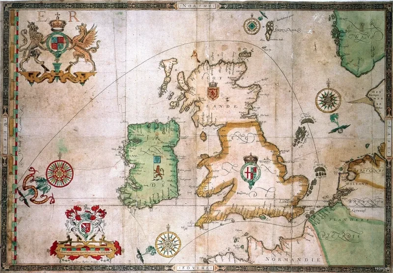
Chart by Lucas Jansz Wagenaer (1584) (G223:2/5)

When exactly did the English Channel start to be called the English Channel? It’s a question with a more complicated answer than you might think. In the early modern period, English, Dutch, and French cartographers all had different ideas about what to call a busy, messy, and ill-defined maritime region. In a time when legal jurisdictions over water overlapped or simply didn’t exist, when charts could be inaccurate or only lightly-detailed, and when there were burgeoning European nations all jostling for trade dominance and political power, the act of naming the Channel could take on proto-imperial importance.
Carta quinta by Robert Dudley and Antonio Francesco Lucini (1646) (G223:1/1)

Maps and charts in the National Maritime Museum’s collections demonstrate just how varied cartographic practice could be when it came to the Channel. The Dutch frequently called it “The Canal Between England and France” (Die Canael tusschen Engelandt ende Franckryct, 1584), but sometimes used “Oceanus Britannicus.” French charts also used “Le Canal entre Angleterre et la France,” embodying the common practice of cartographers of various nations copying each other’s work – but, perhaps with imperial maritime ambitions of his own, Nicolas Desliens published a chart in 1567 which claimed the entire region which is now the southern Channel and a sizable portion of the Atlantic Ocean as “La Mer de France.” In English, an atlas published in 1646 by Sir Robert Dudley may be the first source which named the Channel “The Narrow Seas.” Seventeenth-century English cartographers also called it “The British Sea” or “The British Channel” far before the official 1707 Act of Union. And all of these names join a host of others which are no longer in use in the region, such as “The German Ocean,” a very common label at the time which was applied to various patches of water from Holland’s western coast to what is now the Baltic.
The battle off the Isle of Wight, 4 August 1588 (PBD8529(9))

What many of these charts certainly make clear, however, is that by the late sixteenth century there was a sizable, technical, and relatively accurate body of knowledge about geographical features and sailing patterns and practices in the region. Combined with sailing directions in atlases and texts such as the 1588 Mariner’s Mirrour (an English edition of the 1584 Dutch classic Die Spieghel der Zeevaert by Lucasz Waghenaer) and Hakluyt’s Principal Navigations (which used the intriguing phrase “our English Channel”), these charts were an essential tool in the general European goal of understanding, navigating, and controlling the Channel.