In the far reaches of the Canadian Arctic, a unique ecosystem vanished almost overnight.
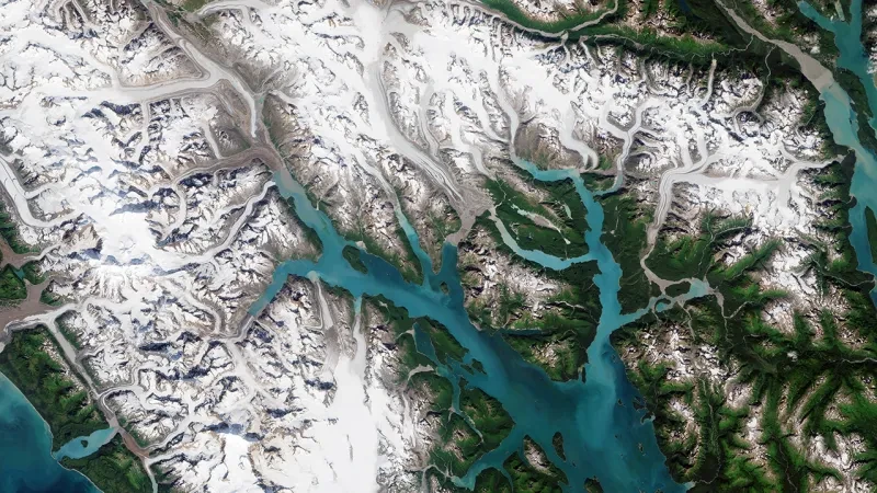
The Milne Fiord, once home to the last epishelf lake in the Canadian Arctic, has undergone a dramatic transformation that illustrates the rapid changes occurring in our polar regions.
Researchers Anna Crawford and Joseph Shoapik witnessed first hand the disappearance of a rare Arctic environment. Their story, shared with the National Maritime Museum as part of Our Ocean, Our Planet, is a stark reminder of the fragility of our planet's most remote ecosystems.
By Anna Crawford and Joseph Shoapik
Touchdown in the Arctic
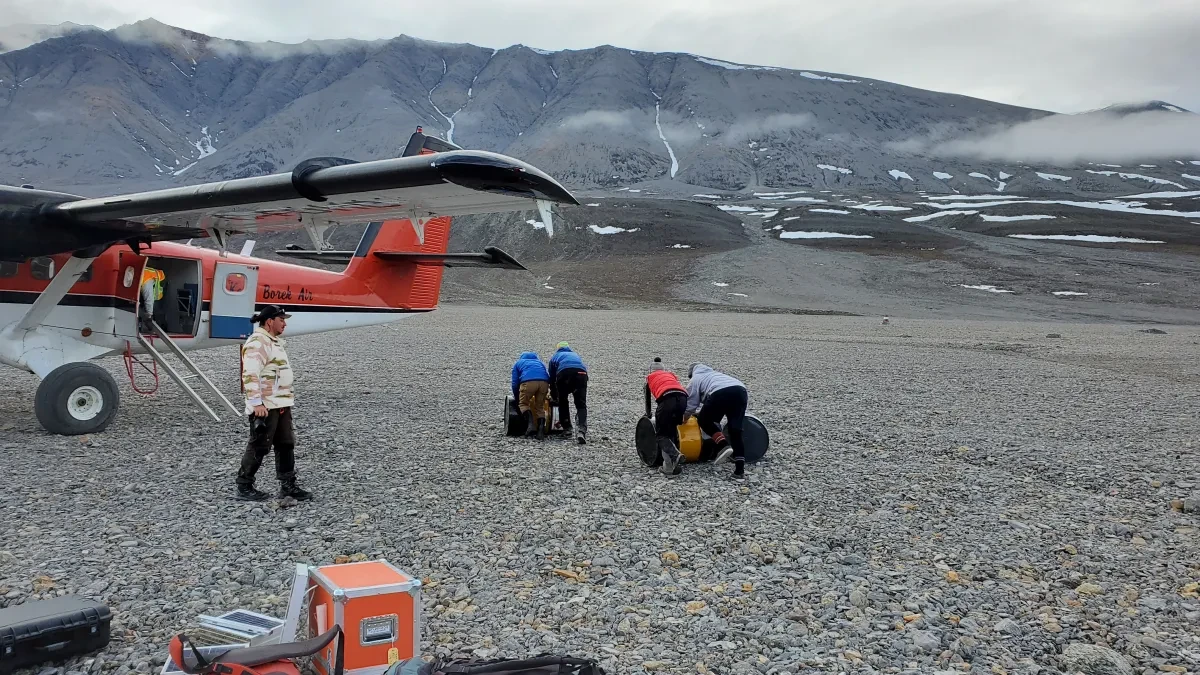
Once its wheels touched the snowy, gravel runway, the noisy Twin Otter aircraft stopped suddenly, jolting us forward into our seatbelts.
A sense of relief was shared among our team upon touchdown. The exciting approach contributed to that feeling, as did the week-long weather delay that previously had us wondering if we would even make it to our destination in the Canadian High Arctic that summer.
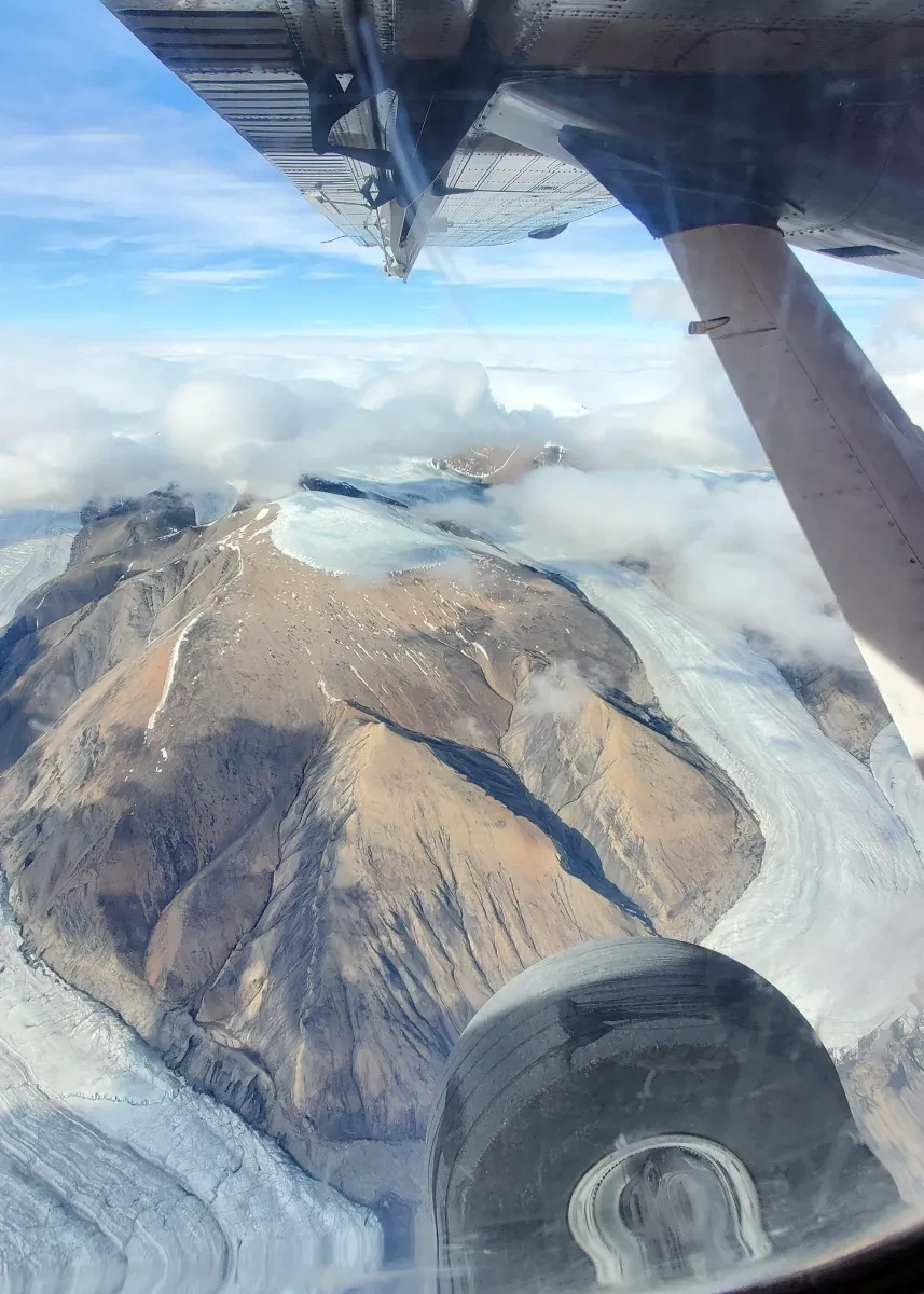
After being treated to scenic views of Ellesmere mountains during the four-hour flight from the Polar Continental Shelf Programme’s headquarters in Resolute, Nunavut, we had finally made it to Purple Valley, Ellesmere Island.
This rocky plateau on the northernmost island of the Canadian Arctic Archipelago was to be our base camp for the next two weeks while we conducted our research programme in the nearby Milne Fiord.
1 / 3
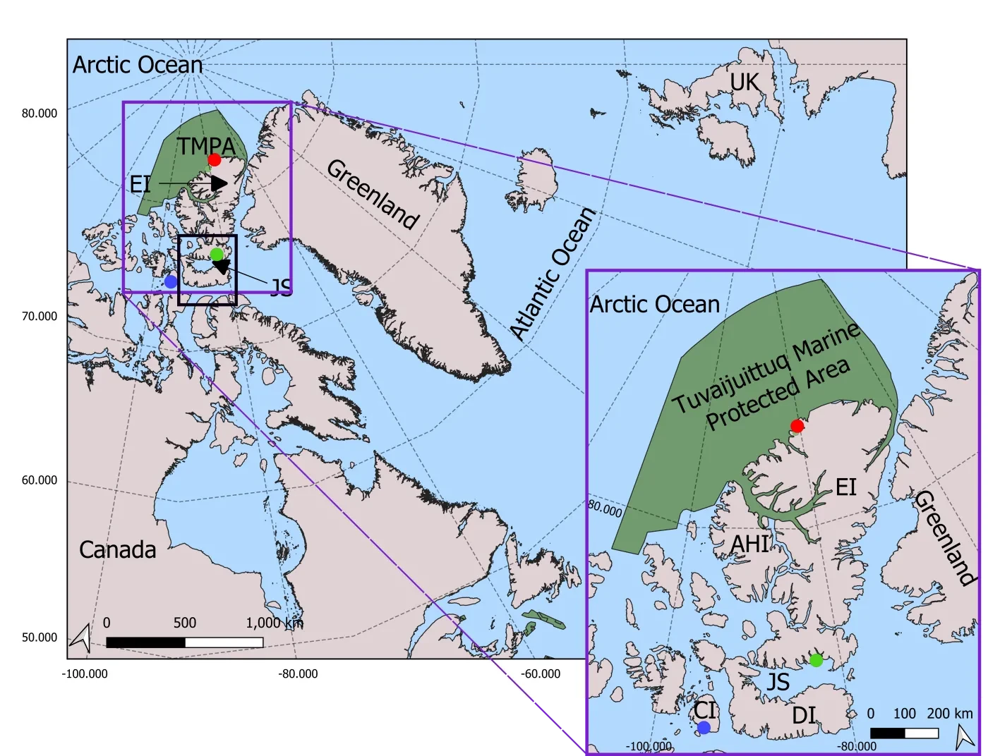
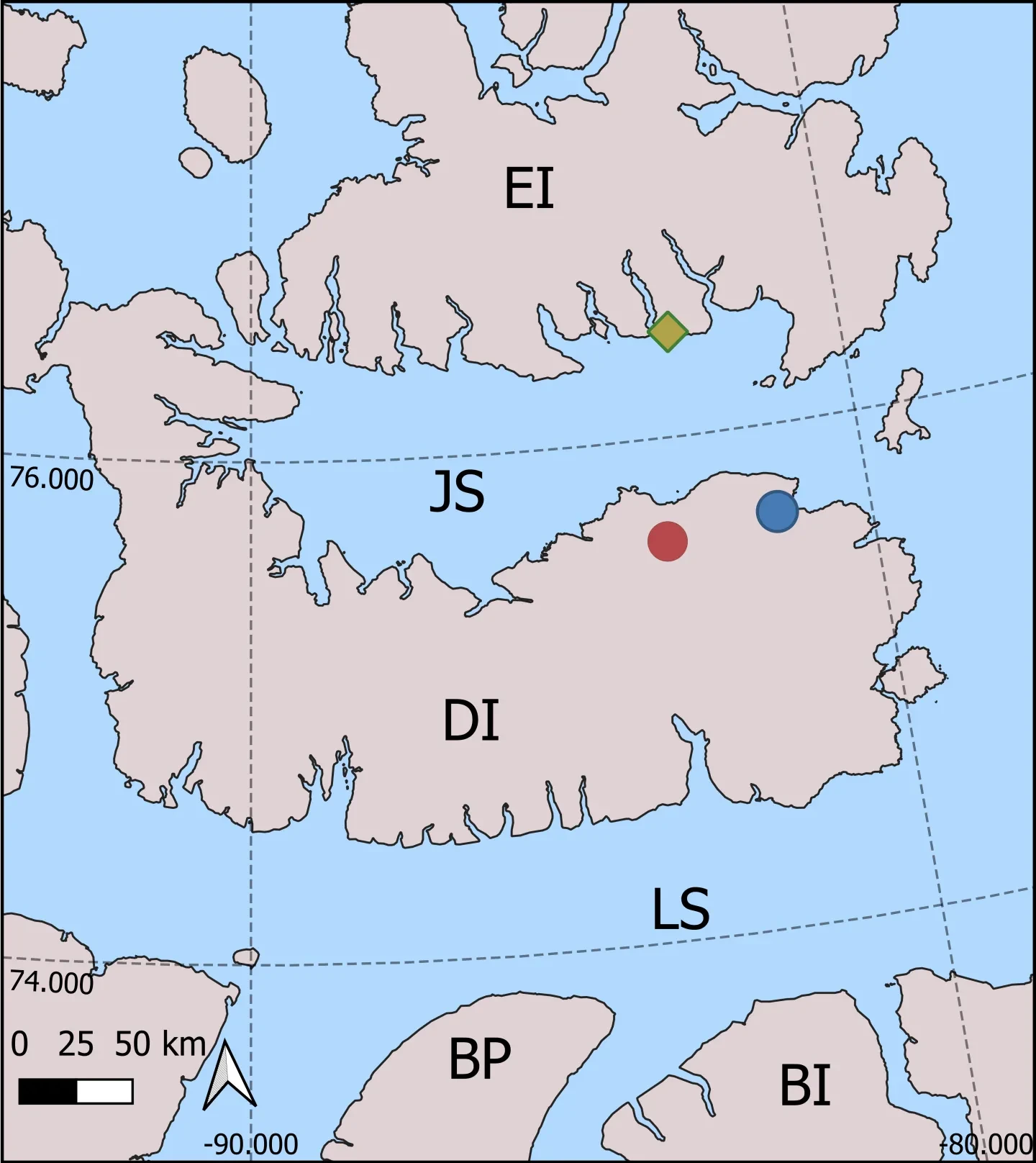
Map showing the location of the Milne Ice Shelf
Location of the Milne Ice Shelf (red dot) and other locations of interest, including Resolute Bay, Nunavut (blue dot) and the Hamlet of Grise Fiord (green dot). The Tuvaijuittuq Marine Protected Area (TMPA), Ellesmere Island (EI), Jones Sound (JS) and the United Kingdom (UK) are also marked.
Marine protected area geospatial data published by Fisheries and Oceans Canada (2023). The black box shows the spatial extent of the map under ‘Changing Sea-ice Conditions’. Coastlines are from the Global Self-consistent, Hierarchical, High-resolution Geography Database (GSHHG; Wessel and Smith, 1996). Contains information licensed under the Open Government Licence – Canada.
2 / 3
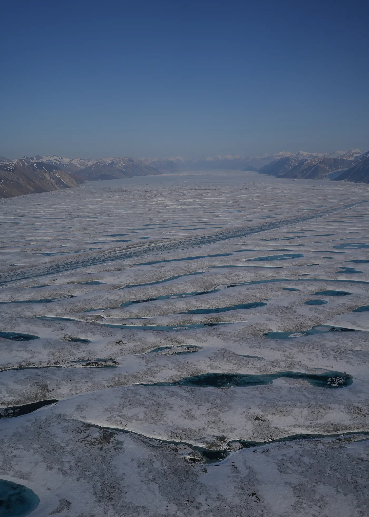
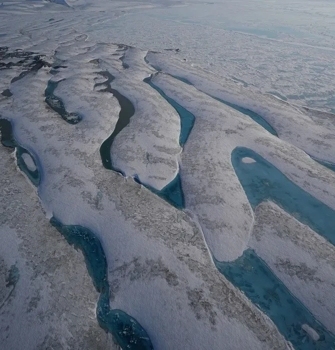
Milne Fiord
Looking up Milne Fiord, with the Milne Ice Shelf in the foreground and the mountains of Ellesmere Island in the background.
Photo by Anna Crawford, reproduced with permission
3 / 3
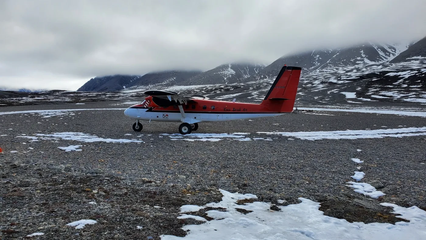
Landing at Purple Valley
The Twin Otter aircraft shortly after landing at Purple Valley on 12 July 2022.
Photo by Joseph Shoapik, reproduced with permission
Milne: the last of its kind
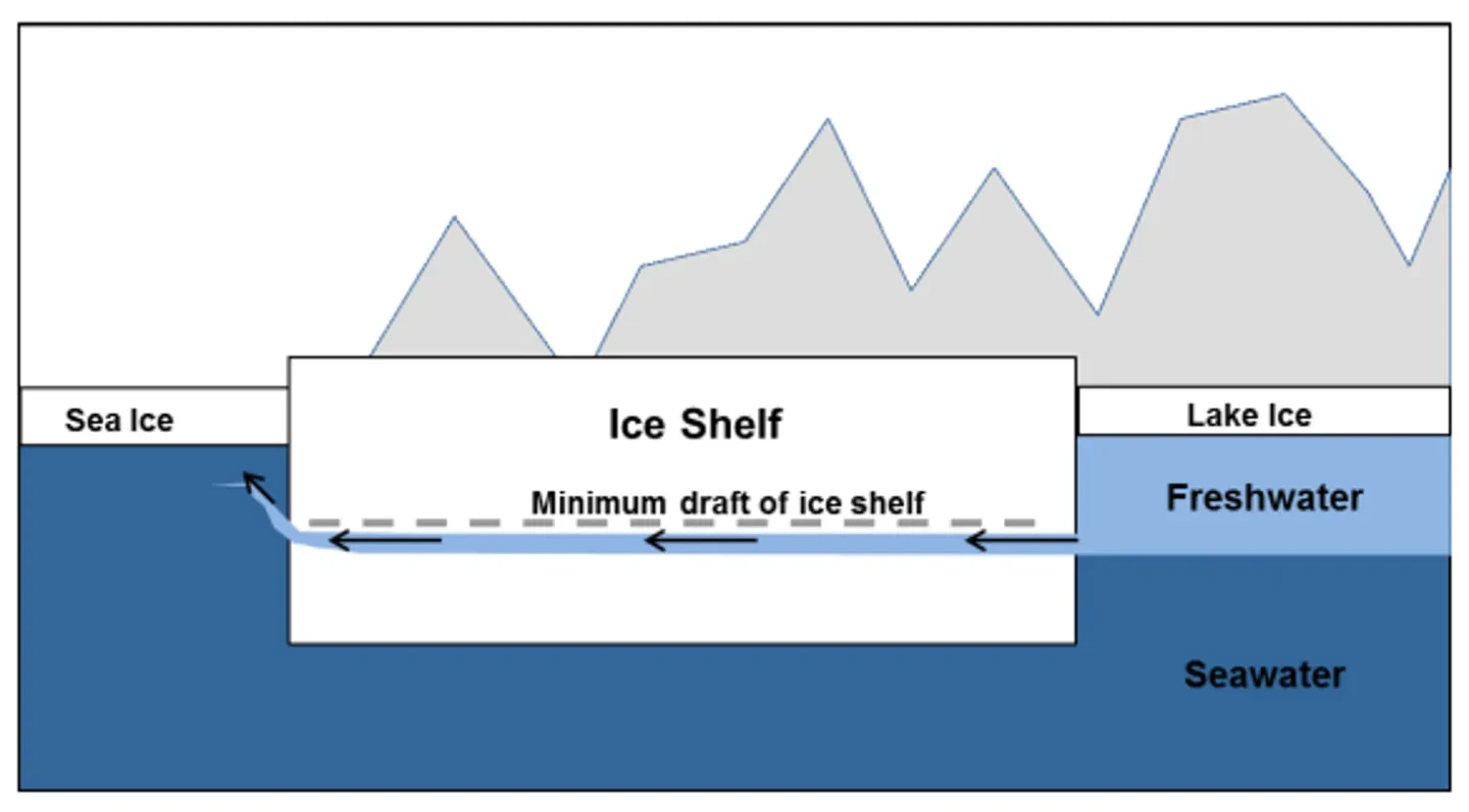
Research teams visit this northerly site annually to study the Milne Fiord. These curious waters are impacted by the Milne Ice Shelf, which sits at the mouth of the fiord and has plugged the freshwater that runs off the land.
Glacier meltwater is fresher and less dense than salty seawater, so the freshwater floats above the seawater when the two water types first meet. An ice shelf (thick ice attached to the coastline) can act as a dam for the freshwater and restrict it from mixing thoroughly with the salty seawater below. This results in the formation of a bottomless freshwater layer that oceanographers refer to as an epishelf lake, as it sits adjacent (or ‘epi’) to an ice shelf.
Epishelf lakes are unique for their distinct water layers, their reliance on ice shelves to exist and the life that they can support, including a diverse community of cold-tolerant microorganisms. The coastline of Ellesmere Island used to be home to at least 17 of these special and rare environmental systems. However, by 2016, the Milne epishelf lake was the last remaining deep epishelf lake in the Canadian Arctic, and one of only a few known locations in the entire Arctic region.
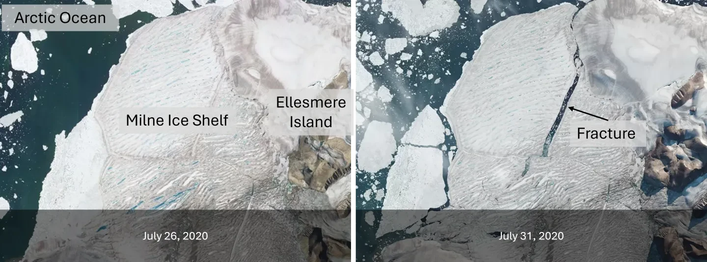
Due to a single traumatic break-up event in July 2020, the Milne Ice Shelf lost 40 per cent of its surface area. Satellite imagery showed a fracture through the major portion that remained. But what was the fate of the epishelf lake?
We could not tell from the satellite images; it was necessary to collect physical data to determine how the properties of the water had been impacted. By the summer of 2022, anticipation had been building for two years, when we – a group of ice- and ocean-focused researchers – could finally make these on-site observations.
A change of plan
After landing at Purple Valley, our attention turned to re-assessing our carefully constructed field plans.
The poor weather that reduced visibility across the Canadian High Arctic that summer and delayed our team’s arrival had also delayed other field teams in reaching their final destinations. This meant less time for each team to use the shared helicopter for research.
We had been relying on helicopter transport to the epishelf lake and ice shelf, where we would set up ice camp for 10 days of focused data collection. Instead, we stayed put at our home base in Purple Valley and prioritised data collection and instrument servicing at far-flung sites when the helicopter was with us.
When the helicopter was not available, we had to walk to data collection sites along Milne Fiord.
We first attempted to access the Milne Glacier by walking across a tributary glacier. However, we were turned away by an impassable field of ice where the tributary met Milne Glacier. As a result, our daily commute to Milne Fiord would involve a 3km (2-mile) walk in the opposite direction.
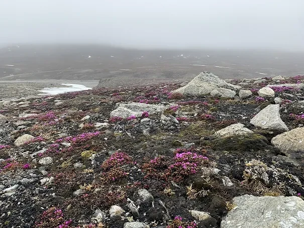
The temperature was comfortable at 2 to 8˚C (36 to 46 ˚F) during our walks, which took us through the saxifrage-covered Purple Valley. We would gain access to the ice cover of Purple Valley Bay, and from there we could make our way onto the ice-capped epishelf lake region of Milne Fiord. It was this route that half the team raced down with a goal of determining the health of the epishelf lake.
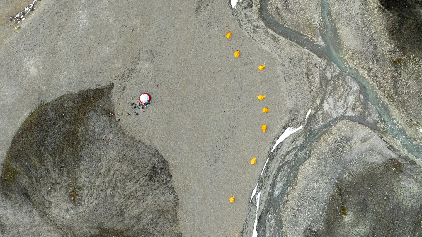
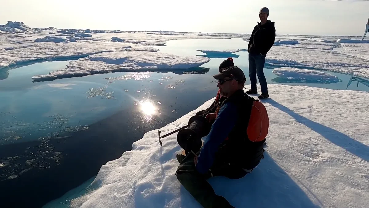
Detecting change in the waters of Milne Fiord
A CTD profiler is an instrument that measures conductivity (C), which allows us to determine salinity, and temperature (T) as the depth (D) of the water increases. The profile would show if the freshwater layer of the epishelf lake was intact or if it had been flushed out some time following the break-up of the Milne Ice Shelf in 2020.
Timelapse of a CTD profile being acquired in Milne Fiord, captured by Erik Wagenaar
To determine the health of the epishelf lake, the conditions recorded in the CTD profile would be compared to previously recorded profiles in the same area. If the freshwater layer was thinner than previously recorded, or if the layer was saltier than before, it would indicate that the ice shelf was no longer able to fulfil its function as a dam protecting the epishelf lake waters.
The conditions within the fiord would then be compared to those of the open ocean to illustrate just how stark, or not, a difference existed between the two water masses. If the CTD profile resembled the open ocean profile, it would indicate that the two bodies of water had mixed.
The open ocean CTD profile is always collected through cracks between sea ice floes. This sea ice can act as a buffer, dampening ocean swell that can work to flex and eventually fracture ice shelves.
But sea ice conditions in the region are evolving.
Sea ice remained next to and protected the remaining Milne Ice Shelf during our field visit. This allowed the helicopter to land so that the team could collect the ocean CTD profile. As we lifted off and flew down the fiord and out to the Arctic Ocean, we curved over the sea ice that was touching the edge of the Milne Ice Shelf. We saw how the ice shelf ended at a cliff line that descended to the sea ice-capped ocean.
A sea ice floe in the Arctic Ocean is a beautifully quiet place to be. When the helicopter settles and the chatter stops, the quiet is only broken by the whirl of the unspooling line of rope lowering the CTD profiler and the crunch of snow as teammates fidget. If you’re ever so lucky, you may catch sight of a nearly translucent fish casually moving past on a solo swim, as we did that summer. But as soon as the CTD profiler is reeled back to the surface successfully, our small team sets off to complete other activities with the profile of ocean conditions in hand.
Milne Fiord's next chapter
Those first field measurements brought us into Milne Fiord's next chapter.
By plotting the graph, the answer to the question we had travelled thousands of miles for was clear: the freshwater layer that had previously extended 16 metres was now only two to three metres deep, closely mirroring the conditions of the open ocean.
The hustle and bustle of preparations to close up camp seemed to delay any type of true reflection on the situation we had just borne witness to. In some ways, after learning of the loss of the epishelf lake, we simply kept marching along to accomplish as many of our science tasks as possible.
We expect more ice shelf loss and more changes to come to Arctic ecosystems, and we have varied reactions to these events. We may grieve what is lost and be anxious about the pace of action to taper society’s greenhouse gas emissions. We may pity the land and ice that is forced to change. We may feel the need to advocate for these environments and wonder about the best way to do so.
There are also so many scientific questions left to answer. What are the implications of this lake drainage on the Milne Glacier and the Milne Ice Shelf? Where does water enter the Milne Fiord? Has water sat on the lake ice cap that floats on the epishelf lake region? How were wind conditions involved in the ice shelf break-up and epishelf lake loss? Water and winds are powerful and both can carve out features in ice and snow. We know that flowing water had previously incised a channel in the Milne Ice Shelf: what was its structure and how has this changed? Did the epishelf lake drain through it, or somewhere else?
Thankfully, there are many before us who have been advocating for the protection of these environments. One example of their efforts is the creation of the Tuvaijuittuq Marine Protected Area.
This interim marine protected area, which includes Milne Fiord, is located across an accumulation of sea ice that has survived and thickened over numerous winters and summers. Cryo-phyllic (ice-loving) algae rely on this sea ice habitat. The persistence of this habitat is critical given that algae form the base of the marine food web that includes polar bears, seals and walrus.
The thick sea ice is also important for travel and hunting by Inuit, and it is expected that sea ice will persist in this region longer than elsewhere as climate change progresses.
The future of ice shelves
Sea ice growth is promoted by cold, calm seas. If conditions allow, the ice will thicken day by day.
Sea ice often drifts with ocean currents, but in some cases, the ice is frozen to the coastline. This ‘fast ice’ is seen each year butting against the Milne Ice Shelf. In the summer, the distance between the ice shelf and the outer edge of the fast ice, known as the 'floe edge', is an indicator of ice shelf stability.
Though relatively thin, sea ice plays an important role in stabilising ice shelves and protecting them from ocean swell. By protecting ice shelves, sea ice helps to conserve those increasingly rare epishelf lakes.
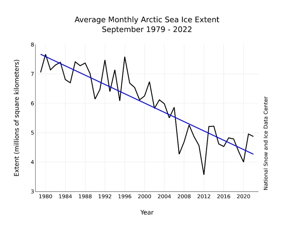
The amount of sea ice in the Arctic is decreasing decade upon decade. The National Snow and Ice Center, based in Boulder, Colorado, US, has documented 3.49 million square km (1.35 million square miles) lost since 1979. This means that the extent of sea ice in 2022 was less than 60 per cent of what existed 40 years ago.
These are regional trends, but the length of time during which there is open water in front of the Ellesmere Island ice shelves each year has also been increasing.
Sea ice conditions, including the location of the floe edge, are changing on the opposite side of Ellesmere Island, too. In January 2023, one of us observed that the unusually short distance from the Hamlet of Grise Fiord, Nunavut, to the floe edge was linked to a period of cold temperatures.
Sea ice conditions (including thickness, extent and type) also have large implications for safe travel and hunting. It used to be possible to travel over 100km (62 miles) east from Grise Fiord. However, since the early 2000s, the amount of sea ice and the position of the floe edge has evolved along the north-east coast of Devon Island, just across Jones Sound.
The spring location of the floe edge can change, with the Belcher and Sverdrup Glaciers on the north-west coast of Devon Island serving as markers for floe edge location each year. The location of the floe edge influences where hunters can travel, as do rain, fog and wind. Strong winds have been observed to promote break-up at the floe edge, and in spring, this prevents hunters from travelling close to the floe edge due to safety risks.
The summer sea ice conditions in Jones Sound have been quite variable in recent years. Some years, lots of ice has clogged certain regions, while in others, there has been no ice to be seen. Both situations restrict summer travel for the community members of Grise Fiord, as too much ice is a hindrance, but too little leads to larger waves to contend with.
More study is needed to understand the numerous and varied consequences of sea ice loss across the Arctic. One consequence of decreasing sea ice extents is the greater vulnerability of ice shelves to fracture, as sea ice dampens the ocean waves that can cause ice shelf flexure and strain.
Such open-water conditions were present when the Milne Ice Shelf experienced its large calving event in July 2020. We need to better understand how sea ice protects ice shelves from fracturing, as this knowledge of sea ice and ice shelf interactions will lead to better predictions of the future fate of ice shelves.
A call to action: preserving Arctic ecosystems
These environmental conditions are reflected in the marine protected area's name. Tuvaijuittuq means ‘the place where the ice never melts’ in Inuktut, which is a spectrum of language dialects spoken by Inuit in Nunavut, Canada.
As an interim marine protected area, no new human activities are allowed within Tuvaijuittuq, apart from Inuit exercising their rights to hunting and fishing, as well as security and emergency needs. These measures are in place for the time being until longer-term protection plans are finalised by the Qikiqtani Inuit Association and the governments of Canada and Nunavut.
The creation of the Tuvaijuittuq marine protected area is a crucial step towards safeguarding these vulnerable environments. However, as our research shows, even protected areas are not immune to the effects of global climate change.
Our carbon emissions have substantial impacts on the evolution of high-latitude landscapes and ecosystems, such as the special ice-ocean environment that previously existed within Milne Fiord. Global action must go hand-in-hand with knowledge exchanges and local conservation efforts to ensure the future of our fascinating icy environments. The fate of the Arctic's ice shelves, epishelf lakes and sea ice depends on actions taken far beyond the polar regions.
The story of the Milne Ice Shelf is not just about loss; it's a call to action. It challenges each of us to consider our role in shaping the future of our planet's most remote and fragile environments.
As we face the realities of a changing Arctic, let us carry forward the lessons learned from the Milne epishelf lake: that every ecosystem matters, that change can happen rapidly, and that our actions – no matter how distant we may feel from the Arctic – have real and lasting impacts on these irreplaceable natural wonders.
About the authors

About the authors
1 / 2
Anna Crawford
Anna Crawford is originally from the small town of Lake George, NY, USA. She is a Lecturer in Physical Geography at the University of Stirling in the United Kingdom. Anna has visited the Canadian Arctic on 12 occasions over her time as a graduate student (Carleton University, Canada) and postdoctoral research fellow (University of Edinburgh, UK). These visits were focused on research of ice shelves and icebergs, two subjects that she continues to find intensely interesting in this era of Arctic change.
2 / 2
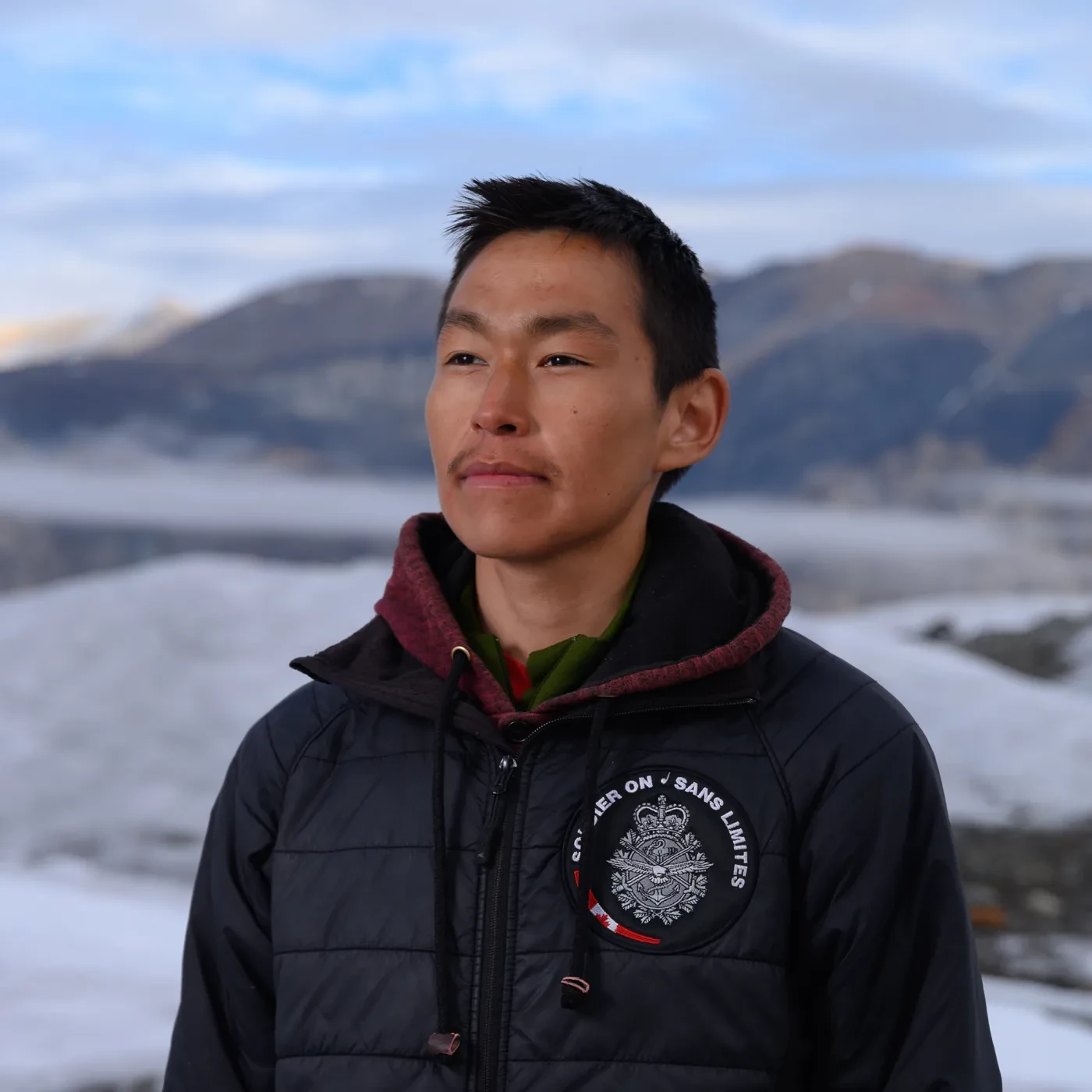
Joseph Shoapik
Joseph Shoapik is from Aujuittuq, the Hamlet of Grise Fiord, in Nunavut, Canada. Aujuittuq is located in the southeast region of Ellesmere Island, Nunavut, Canada. Joseph joined the 2022 trip to Milne Fiord as the local environmental specialist and field assistant. Joseph was a technical staff member of ArcticNet’s GO-Ice programme (2019-2024) and a community-based researcher associated with POLAR Knowledge Canada's Glacier2Ocean Watch programme (2021-2025).
References and acknowledgements
DFO (Department of Fisheries and Oceans) 2024. Tuvaijuittuq Marine Protected Area (MPA). dfo-mpo.gc.ca/oceans/mpa-zpm/tuvaijuittuq/index-eng.html#ecosystem (accessed on 14 November 2024)
Jungblut, A., Mueller, D., & Vincent, W.F. (2017). Arctic Ice Shelf Ecosystems. In: Arctic Ice Shelves and Ice Islands (Eds., Copland, L., & Mueller, D.). Springer Polar Sciences, The Netherlands. pp: 227-262. doi: 10.1007/978-94-024-1101-0_9
Planet Team (2017). Planet Application Program Interface: In Space for Life on Earth. San Francisco, CA.
Rajewicz, J. 2017. Channelized Epishelf Lake Drainage Beneath the Milne Ice Shelf, Ellesmere Island, Nunavut. MSc Thesis. Carleton University, Ottawa, Canada.
Veillette, J., Lovejoy, C., Potvin, M., Harding, T., Jungblut, A. D., Antoniades, D., Chénard, C., Suttle, C. A., & Vincent, W. F. (2011). Milne Fiord epishelf lake: A coastal Arctic ecosystem vulnerable to climate change. Écoscience, 18(3), 304–316.
Vincent, W.F. & Mueller, D. (2020). Witnessing ice habitat collapse in the Arctic. Science. 370(6520), 1031-1032. doi: 10.1126/science.abe4491
Wessel, P. & W. H. F. Smith, A. (1996). Global Self-consistent, Hierarchical, High-resolution Shoreline Database, J. Geophys. Res., 101, #B4, pp. 8741-8743.
White, A. 2012. Dynamics and Historical Changes of the Petersen Ice Shelf and Epishelf Lake, Nunavut, Canada, Since 1959. MSc thesis, University of Ottawa, Ottawa, Canada. 103 pp.
QIA (Qikiqtani Inuit Association). 2023. Tuvaijuittuq. qia.ca/what-we-do/parks-and-conservation-areas/#tuvaijuittuq. Accessed 13 December 2023.
We are grateful to the Trebek Initiative for supporting the 2022 field visit to the Milne Fiord. A Crawford was also financially supported by the Leverhulme Trust, while the larger expedition received support from ArcticNet, the National Science and Engineering Research Council (Canada), and the Polar Continental Shelf Program of Natural Resources Canada. The 2022 field team consisted of Derek Mueller (Carleton University), Jérémie Bonneau (University of British Columbia), Cameron Fitzpatrick (Carleton University), Erik Waganaar (Carleton University), Alex Forest (University of California Davis), Dustin Patar (Iqaluit, Nunavut), Joseph Shoapik (Hamlet of Grise Fiord, Nunavut) and Anna Crawford (Universities of Edinburgh and Stirling). The ongoing research program at Milne Fiord builds on years of previous study, with contributions from Andrew Hamilton, Derek Mueller, Luke Copland, Jill Rajewicz, Colleen Mortimer, Adrienne White, Nat Wilson, Drew Fredrichs.
Main image by Erik Wagenaar, reproduced with permission
Find more stories like this
Ice cores and climate change
By extracting ice cores from Antarctica, scientists are able to travel more than 800,000 years back into Earth’s climate history
Why satellites are critical to fighting climate change
The polar ice sheets are melting six times faster than the 1990s. But thanks to earth observation satellites, we can at least measure the effect that climate change is having
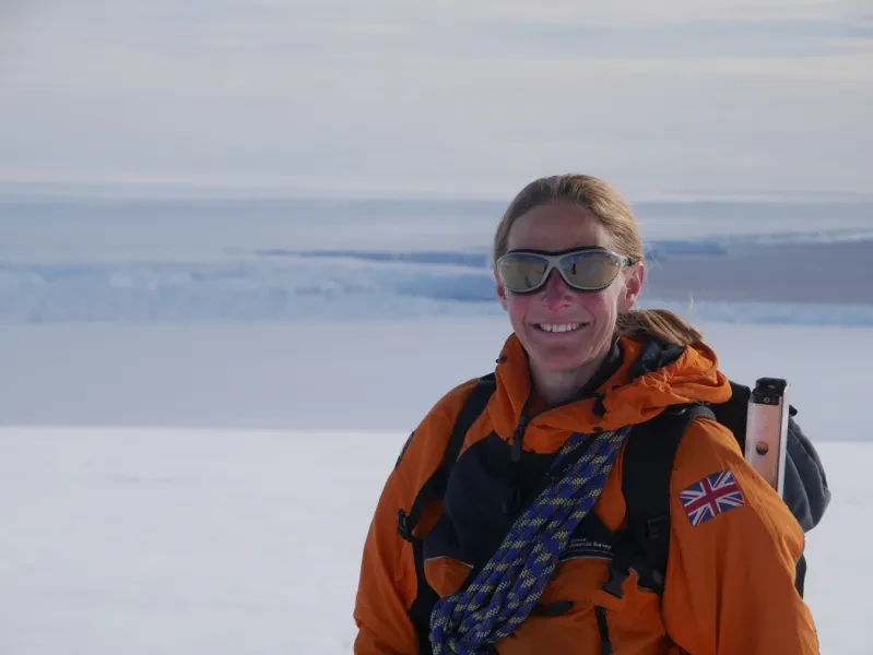
What's it like to be a polar scientist?
Find out what it's like to live and work in the Antarctic with British Antarctic Survey scientist Joanne Johnson
Our Ocean, Our Planet
Our Ocean, Our Planet is a new online space at Royal Museums Greenwich dedicated to exploring the climate crisis and our relationship with the ocean
Visit the National Maritime Museum